
Helping people move through two St Heliers Bay Road intersections
Engagement outcome
We would like to thank the members of the community who shared their feedback on these two projects. Based on what we heard, we have decided to proceed with implementing both projects, with some minor changes to the project designs.
More information about the feedback we received, as well as our responses, is available in the public feedback report. To download the report, go to the "Public feedback report" section of this page.
St Heliers Bay Road at St Johns Road and Kohimarama Road intersection final design plan
We have decided to move forward with implementing this project with one small design change. The finalised changes are as follows:
- Change the middle through lane on St Johns Road into a second right-turn lane.
- Create a new cyclist-pedestrian shared path connection on St Heliers Bay Road approaching the intersection for people walking, cycling, or riding a scooter.
- Changes to bus stop ID 7836 to make room for the new shared path. After hearing community feedback, we decided to further widen the shared path space around the stop and bus shelter to better accommodate cyclists and pedestrians passing through.
- Build a bigger concrete pad at the bus stop in front of St Thomas Church (stop ID 7843).
- Install no stopping at all times broken yellow lines on both sides of St Johns Road roughly between properties 355 and 360.
St Heliers Bay Road at Long Drive and Ashby Avenue intersection final design plan
We have decided to move forward with implementing this project with some small design changes. The finalised changes are as follows:
- Create two new lanes - one for right turning and one for left turning and going straight - on each side of the intersection.
- Optimise the traffic signal phasing to ensure traffic moves smoothly using the new lanes.
- Make kerb adjustments on the northeast corner of the intersection (at Long Drive opposite from the Caltex petrol station) to allow enough room for the new lanes.
- Move the bus stop on St Heliers Bay Road by Ashby Avenue (stop ID 7740) across to the opposite side of the intersection. After hearing community feedback, we have decided to move the stop further away from its originally proposed location in front of property 232 St Heliers Bay Road to in front of property 234 St Heliers Bay Road. Moving the stop here will allow more room for vehicles to safely pass around stopped buses and reduce the risk of traffic backing up into the middle of the intersection.
- Install new no stopping at all times broken yellow lines on all sides of the intersection around the new marked lanes so that parked cars don't block traffic flow. After receiving some requests from the community for more broken yellow lines on Ashby Avenue, we decided to lengthen the broken yellow lines on the side of Ashby Avenue heading towards the intersection by an additional 8 metres. This change will help further reduce the chance of parked cars blocking traffic flow on this side of the intersection, especially at busy times.
- Install yellow tactile pavers on all the pedestrian crossings and other accessibility improvements, such as improved ramps.
We've updated the "Detailed design drawings" section of this page with the finalised design plans for both projects.
We plan to deliver them in the first half of 2026. We'll notify the community as soon as we're ready to begin construction.
About the projects
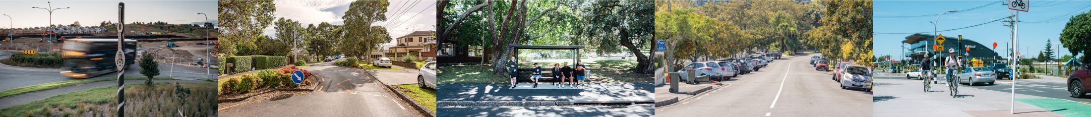
St Heliers Bay Road is an important road in Central Auckland, with many homes, businesses and schools. About 13,000 vehicles travel it each day, and it serves as a key route for many buses, service and supply vehicles. Many people also walk and cycle along the road.
We’ve identified some changes we can make to two busy intersections - St Heliers Bay Road at St Johns Road / Kohimarama Road and St Heliers Bay Road at Long Drive / Ashby Avenue - that would help reduce congestion and delays and create better journeys for all who travel here. These changes can be delivered quickly, at relatively low cost and with minimal disruption to the community.
Together the changes will help more traffic move more quickly through both intersections, reduce backups and delays at busy times, and create safer, more reliable journeys for everyone, however they’re travelling. They include creating more lanes for turning vehicles, moving and widening some bus stops, making some pedestrian crossings more accessible, and adding a new off-road shared path connection for cyclists and pedestrians.
What we proposed
St Heliers Bay Road at St Johns Road and Kohimarama Road intersection
The changes we proposed at this intersection aim to address the biggest contributors to congestion and delays, help more vehicles move at busy times, create a safer space for cyclists to travel from St Heliers Bay Road, and improve the quality of one of the bus stops.
 Map of the originally proposed changes to St Heliers Bay Road-St Johns Road-Kohimarama Road intersection
1. Change the middle through lane on St Johns Road into a second right-turn lane. Right-turning traffic from St Johns Road is the main driver of delays and congestion at the intersection. Creating another turn lane gives this traffic more space to queue and help get more vehicles through on green lights. We'll also be making minor adjustments road markings on the other sides of the intersection so that all traffic continues flowing safely once the new right-turn lane is ready.
2. Create a new cyclist-pedestrian shared path connection for people on active modes (cycling, walking, riding an e-scooter, etc.) approaching the intersection from St Heliers Bay Road. This provides a safer way for cyclists and other active modes travellers coming from St Heliers Bay Road to travel through the intersection, separate from vehicle traffic, and continue on to places like the Glen Innes to Tāmaki Drive Shared Path – Te Ara Ki Uta Ki Tai. The new connection starts with a green painted cycle lane for cyclists to move off the road and onto the footpath, where the new cyclist-pedestrian shared path will be. It then continues along the footpath to the pedestrian crossings at the intersection and to other existing shared paths.
3. Changes to bus stop ID 7836 to make room for the new shared path. We'll need to slightly widen the footpath by this stop and move the existing bus shelter a little further back from the kerb.
4. Build a bigger concrete pad at the bus stop in front of St Thomas Church (stop ID 7843). This change gives people at this stop more space to wait for their bus.
5. Install no stopping at all times broken yellow lines on both sides of St Johns Road roughly between properties 355 and 360. This change is necessary to ensure parked cars are not blocking traffic moving along St Johns Road, especially in the remaining through lanes. It will also help ensure parked cars are not blocking drivers' ability to access their driveways at properties along this part of the road.
St Heliers Bay Road at Long Drive and Ashby Avenue intersection
The changes we proposed at this intersection aim to address the biggest contributors to congestion and delays, give more vehicles more room to move through at busy times, and make the pedestrian crossings more accessible to people of all abilities.
 Map of the originally proposed changes to St Heliers Bay Road-Long Drive-Ashby Avenue intersection
Map of the originally proposed changes to St Heliers Bay Road-Long Drive-Ashby Avenue intersection1. Create two new lanes - one for right turning and one for left turning/going straight - on each side of the intersection. The biggest reason for congestion and delays at this intersection is informal or inconsistent queuing of turning traffic because there aren't any designated turn lanes. These new lanes will reduce the chance of this happening by giving people dedicated space to queue. We're also upgrading the traffic lights with new green light arrows for the turning traffic and optimising the signal phasing to ensure traffic flows smoothly through the new layout.
2. Slightly adjusting one of the kerblines on Long Drive to support the new lanes. We need to make some slight adjustments to the kerbline on the corner of Long Drive and St Heliers Bay Road (near 211 St Heliers Bay Road) to make enough space for the new lanes on that side. We'll need to cut back the kerb a little and repave the new road space. This will make the grass berm on this corner a little shorter, but it will have no impact on the footpath.
3. Move the bus stop on St Heliers Bay Road by Ashby Avenue (stop ID 7740) across to the opposite side of the intersection. Currently, this bus stop sits on St Heliers Bay Road on the eastern side of the intersection (in front of property 220), in the space where we want to put the new turn/through lanes on this side. We originally proposed to move this bus stop across to the western side in front of property 232 so that it's still easy for bus riders to get to and vehicles have all the available road space in the new lanes to queue. We're now moving it slightly further down to in front of 234 St Heliers Bay Road after listening to community feedback.
As shown in the Map Key:
Install yellow tactile pavers and other accessibility improvements at the pedestrian crossings. Along with the new tactile pavers for the visually impaired, we're fixing up the crossing ramps so they're better for people on wheelchairs as well as people riding scooters or who like to walk their bikes through the crossings.
Install new no stopping at all times broken yellow lines around the intersection on all sides. This change is necessary to ensure parked vehicles are not blocking any of the traffic in the new lanes on any side of the intersection and to provide smoother entry and exit for buses at the bus stops.
Public feedback report

Have a question?
-
Send your questions to AT Engagement

Email ATEngagement@at.govt.nz