

Keeping Upper Harbour moving
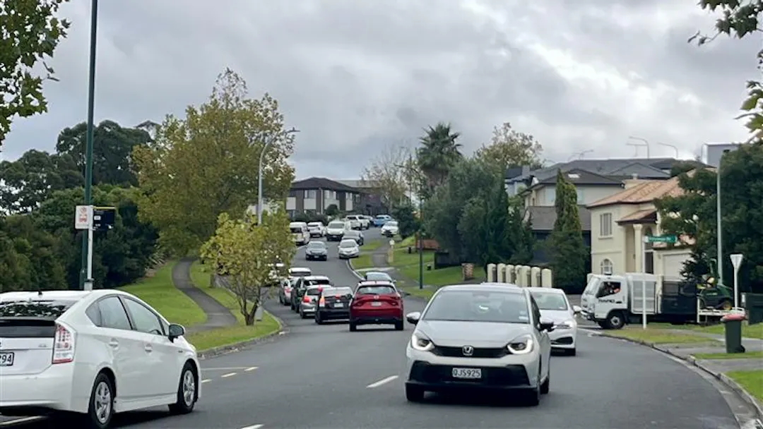
We are making a number of practical improvements across Auckland to help manage congestion, improve travel reliability and make our roads safer.
The Auckland Network Optimisation programme focuses on known congestion hotspots where relatively simple changes can make a difference. By making better use of existing road space, we can deliver targeted improvements without the need for major construction.
In Upper Harbour, we are bringing into fruition these two projects:
- Albany Expressway / Bush Road / Mercari Way intersection improvement
- Greville Road / Hugh Green Drive optimisation
These projects focus on addressing specific issues at busy intersections and roads, with changes designed to be practical, targeted and relatively quick to deliver.
Albany Expressway / Bush Road / Mercari Way
For information in:
Mandarin- Click here
Korean- Click here
The Albany Expressway, Bush Road and Mercari Way intersection experiences congestion throughout the day, particularly during busy periods. At the most congested times, speeds can drop below 10km/h.
We’re proposing changes to make better use of the existing lanes and improve pedestrian facilities at the intersection.
What’s proposed?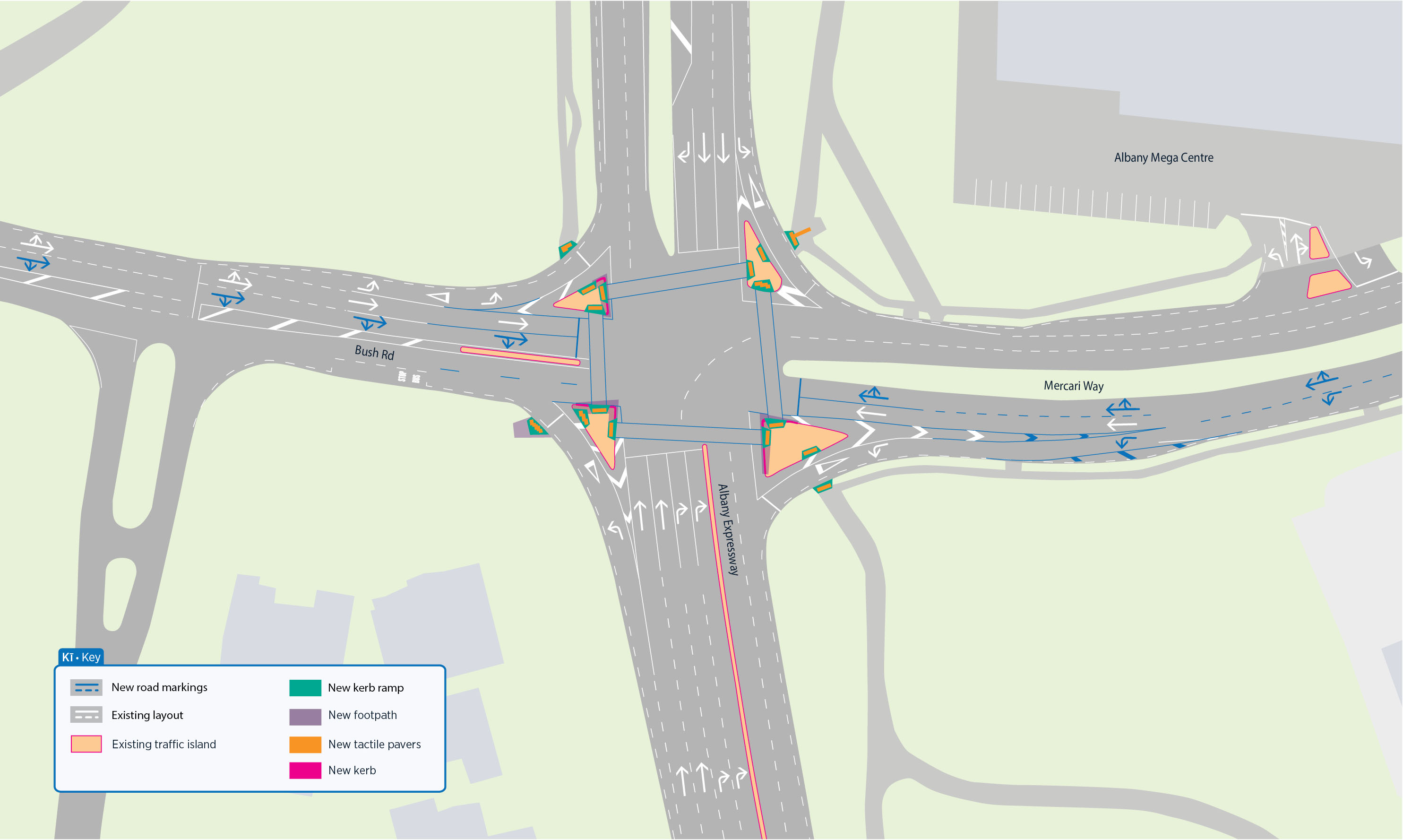
- A better use of existing lanes: The dedicated right-turn lanes on northbound Bush Road and southbound Mercari Way would be changed to allow both right-turn and through movements. This would provide more capacity for vehicles travelling through the intersection and reduce delays.
- Safer pedestrian facilities: we're planning improvements to the pedestrian facilities, including wider pedestrian crossings, proper ramps and tactile indicators on the traffic islands.
What will this achieve?
The changes are designed to:
- Reduce delays through the intersection
- Improve traffic flow during busy periods
- Make better use of existing road space
- Improve accessibility and safety for people walking through the intersection
The proposed changes may be refined ahead of installation.
Greville Road / Hugh Green Drive
For information in:
Mandarin- Click here
Korean- Click here
Hindi- Click here
Congestion begins building on this busy road from around 3.30pm, with northbound traffic speeds dropping to around 10–13km/h.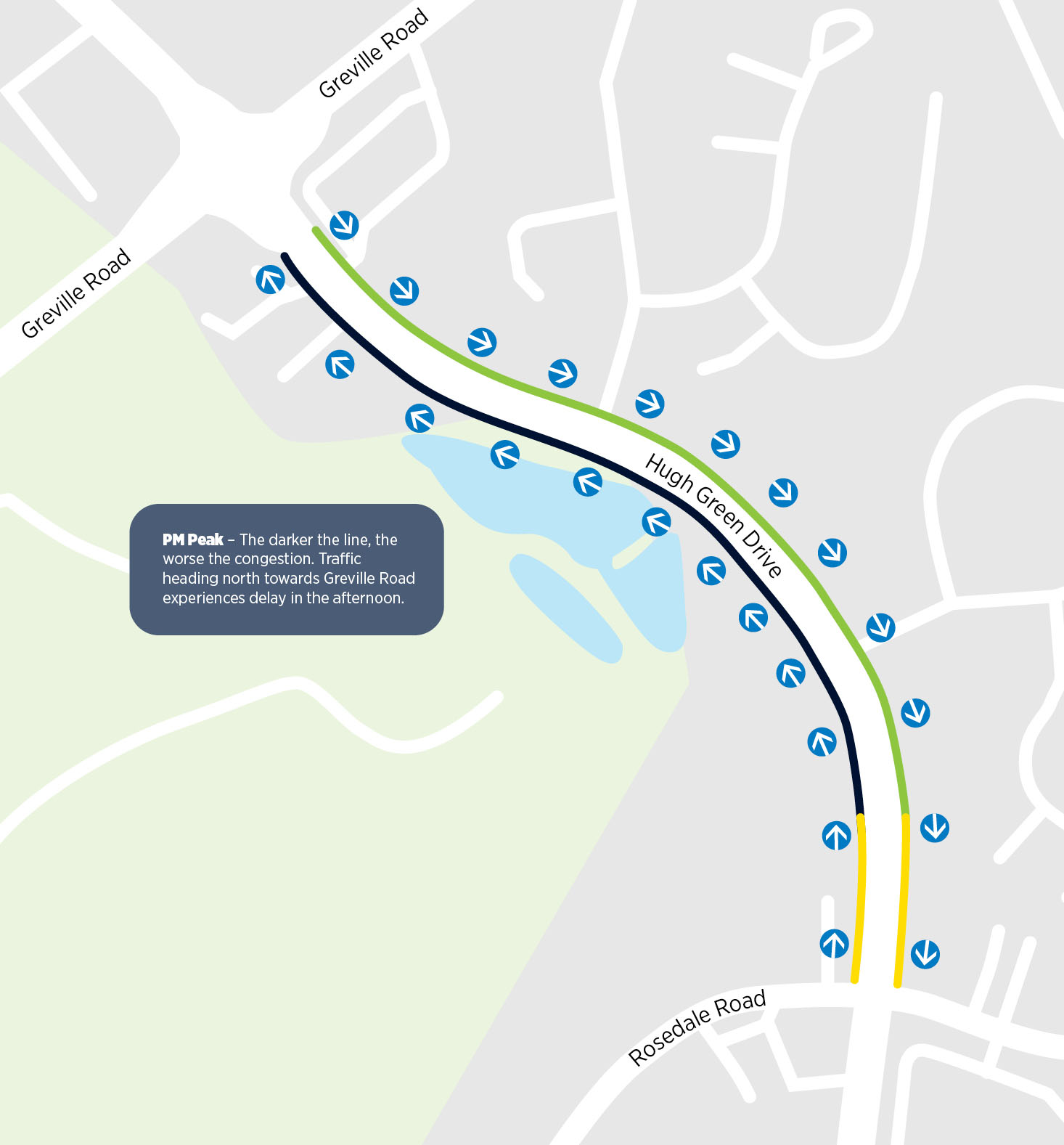 Queues can extend along Hugh Green Drive and back towards the Rosedale Road / Apollo Drive roundabout, creating delays for people travelling through the area.
The current layout means vehicles heading towards Greville Road are largely held in a single lane, reducing the amount of traffic that can move through the intersection.
What’s proposed?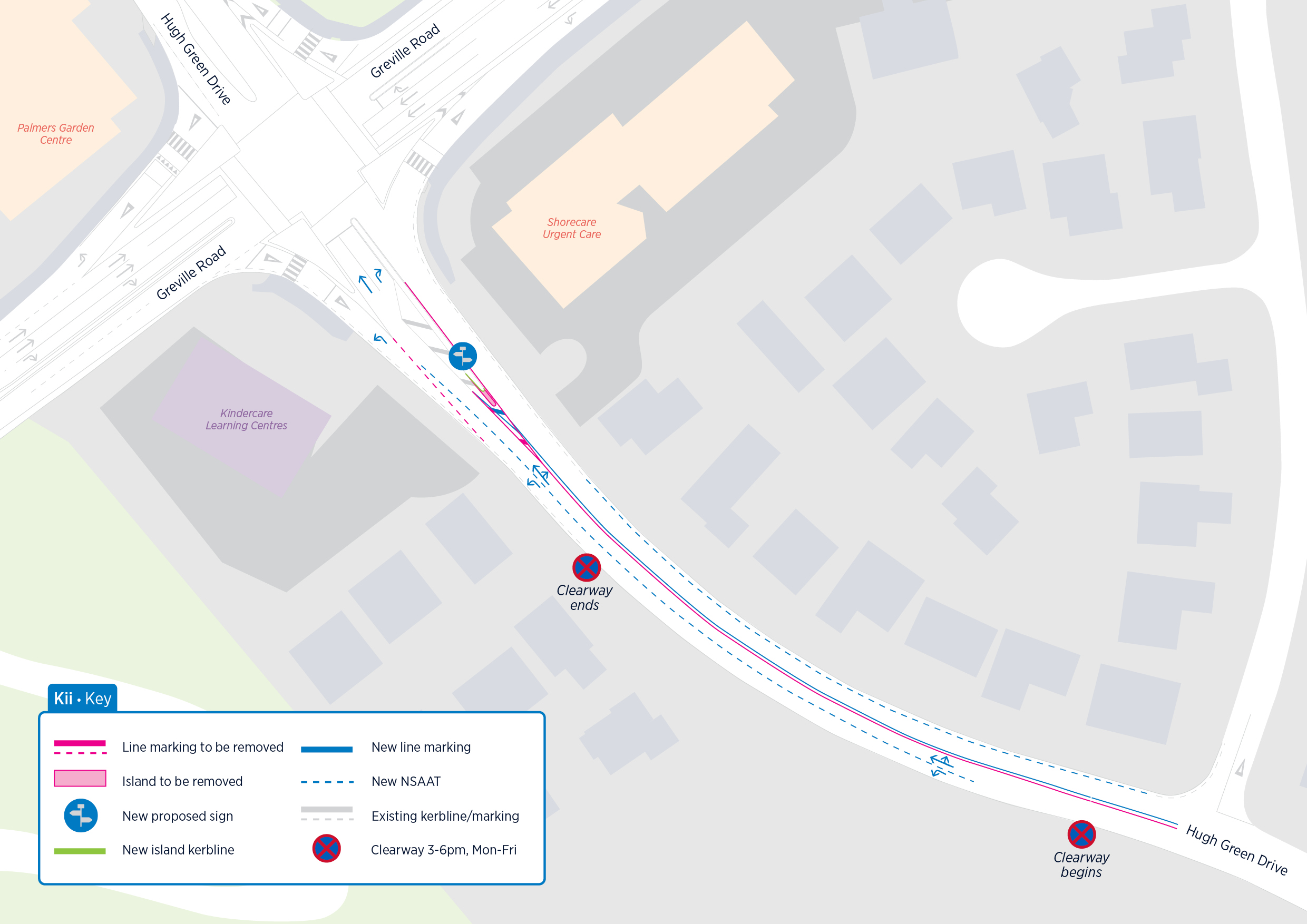
- We’re proposing a package of small, targeted changes to help traffic move through this known congestion point more efficiently.
- Extend the left-turn lane
- The left-turn lane towards Greville Road would be extended by around 200 metres, allowing vehicles turning left to enter the slip lane earlier and reducing the amount of traffic held behind them.
- Weekday clearway: A 3–6pm weekday clearway would create additional road space when congestion is highest.
- Updated no-stopping lines: New no-stopping lines would be introduced along the lane towards the roundabout and around the bus stop to keep the lane clear and improve visibility and safety.
- Minor layout changes: The traffic island outside Shore Care would be modified to support smoother and more predictable traffic movements.
What will this achieve?
The changes are expected to:
- Reduce queue spillback
- Address the existing bottleneck
- Allow left-turning traffic to move into the slip lane earlier
- Reduce delays at the Greville Road signals and roundabout by up to 30 seconds
The project will affect parking, with 15 spaces permanently removed and a further 18 spaces unavailable during the 3–6pm weekday clearway.
Practical changes using existing road space
These projects are part of our wider approach to network optimisation: finding practical ways to improve how our existing roads work, rather than relying on major infrastructure projects.
The focus is on targeted, low-cost changes that can be delivered relatively quickly; such as changes to lane use, clearways, road markings, traffic islands and pedestrian facilities.
Most of the work is expected to take place within the existing road space,
Together, these improvements will help make travel through Upper Harbour more reliable, safer and more efficient, while making better use of the road space we already have.
What happens next?
We are currently progressing the detailed design for both projects.
Subject to the project process and final design, construction is expected between late 2026 and mid-2027.
We will be in touch with residents before any construction takes place.
More information, including maps and detailed changes, will be provided as the projects progress.
How to contact us:
If you’d like to speak to someone about our plans, please email us at ATEngagement@at.govt.nz.
