Feedback Report Now Available
Thank you to everyone who shared their feedback on the Browns Bay Town Centre Safety Improvements. We’ve listened and carefully considered all the input received as part of this engagement process. The Feedback Report is now available to view here.
We appreciate your contribution and will continue to keep you updated as the project progresses.
Engagement Closed – Thank You
Kia ora, thank you for sharing your feedback on the Browns Bay Town Centre Safety Improvements. The engagement period has now closed, and all responses will be reviewed by the project team. We appreciate your input and look forward to keeping you updated as the project progresses.
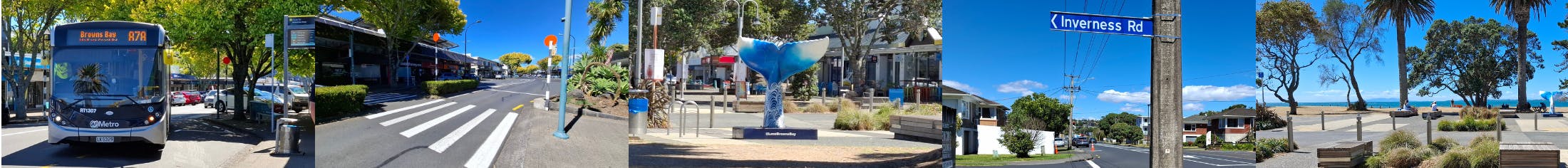
About the project
We’re making safety improvements for people walking, cycling and driving within the Browns Bay Town Centre to ensure everyone gets where they need to and home safely.
We’re creating safe streets in the town centre getting you to your school, local shops and all the places you love in a way that is good for you, your whānau and the environment.
Why this is important:
- Improving safety: The proposed changes will improve safety in the Browns Bay town centre by encouraging drivers to slow down and drive with caution as well as provide safer crossing for people on foot around the town centre.
- Lack of safe crossings: There are limited safe crossing options to help people on foot cross the road safely. We propose installing more to improve safety for the community, especially for children and families accessing schools and parks.
- Supporting the Community: The area is busy with nearby retirement villages, schools, parks, and businesses, so these changes will make it easier and safer for everyone to get around.
Share your local insights or if there’s anything we’ve missed by 25 May 2025. Drop a pin on the map below.
The changes will include:
The changes will improve safety in the Browns Bay Town Centre by encouraging drivers to slow down and drive with caution and provide safer crossing for people on foot around the town centre.
Please refer to the right-side of the website for our full proposed designs.
Site 1: Valley Road and Manley Esplanade
 Drawing of Site 1 - Valley Road
• Gateway Threshold (red markings) with *a possible speed limit change: Kerb buildouts, traffic signs (Browns Bay Town Centre), and red road markings will be added at the entry points of the town centre to alert motorists that they're entering a new area, encouraging them to slow down and drive cautiously.
• No Stopping At All Times Lines/road markings to improve visibility for drivers to see around corners and over blind spots on Valley Rd.
• New road markings and a mountable traffic island will be placed near the Manly Esplanade intersection to better define the road layout, guiding motorists and improving overall traffic flow.
*note - Any proposed speed limit change will be subject to a separate speed limit consultation.
Site 2: Beach Front Lane
 Drawing of Site 2 - Beach Front Lane
• New zebra crossings will be installed on existing raised tables along Beach Front Lane.
• Tactile pavers will also be added to these crossings, providing better navigation aids for visually impaired people walking.
Site 3: Bute and Clyde Road
 Drawing of Site 3.1 - Bute Road Gateway Threshold
• Gateway Threshold (red markings) with *a possible speed limit change: traffic signs (Browns Bay Town Centre), and red road markings will be added at the entry points of the town centre to alert motorists that they're entering a new area, encouraging them to slow down and drive cautiously.
 Drawing of Site 3.2 - Clyde Road
• Kerb Buildouts will be installed at various crossing points along Bute and Clyde Rd.
• These kerb buildouts will extend the footpath into the roadway, reducing the crossing distance for people on foot and making them more visible to motorists.
• Tactile pavers will be added to zebra crossings to aid visually impaired people on foot.
• New signs and road markings will enhance the safety of people walking and compliance with traffic regulations.
• Parking space to be converted from any car to motorcycle parking space.
• Additional parking space gained beside the Bute Rd kerb buildout.
• A new zebra crossing will be added on Clyde Rd outside No. 36, replacing the existing one outside No. 35. This will improve safety and convenience for people on foot.
• A new zebra crossing will be added on Clyde Rd, before the Clyde Rd and ANZAC Rd roundabout, including new traffic islands and directional tactile pavers to aid in better navigation for the visually impaired.
• Existing crossing islands on Clyde Rd near the roundabout will be widened, providing people on foot with a safer and more spacious waiting area as they cross the road.

Drawing of Site 3.3 - Clyde Road Parking Space
• An additional parking space will be added on Clyde Road near the roundabout.
 Existing crossing islands on Clyde Rd near the roundabout will be widened, providing people on foot with a safer and more spacious waiting area as they cross the road.
*note - Any proposed speed limit change will be subject to a separate speed limit consultation.
Site 4: Inverness Road

Drawing of Site 4.1 - Inverness Road Gateway Threshold
• Gateway Threshold (red markings) with *a possible speed limit change: Kerb buildouts, traffic signs (Browns Bay Town Centre), and red road markings will be added at the entry points of the town centre to alert motorists that they're entering a new area, encouraging them to slow down and drive cautiously.
• New widened footpath with proposed low-lying vegetation at the corners of Beach and Inverness Road.
• No stopping at all times will be added to reallocate road space to enhance visibility and safety of people crossing.

Drawing of Site 4.2 - Inverness and Glen Road
• Zebra crossing to be installed on existing raised table near the Glen Rd/Inverness Rd intersection, enhancing visibility and safety. Tactile pavers will be added to aid the visually impaired.
• The kerb and footpath will be extended out to be in line with the carpark to improve visibility for people crossing.
• No stopping at all times will be added to reallocate road space to enhance visibility and safety of people crossing.
*note - Any proposed speed limit change will be subject to a separate speed limit consultation.
Site 5: ANZAC Road

Drawing of Site 5.1 - ANZAC Road Gateway Threshold
• Gateway Threshold (red markings) with *a possible speed limit change: Kerb buildouts, traffic signs (Browns Bay Town Centre), and red road markings will be added at the entry points of the town centre to alert motorists that they're entering a new area, encouraging them to slow down and drive cautiously.

Drawing of Site 5.2 - ANZAC Road Flush Road Markings
*note - Any proposed speed limit change will be subject to a separate speed limit consultation.
Site 6: Browns Bay Road

Drawing of Site 6 - Browns Bay Road Gateway Threshold
• Gateway Threshold (red markings) with *a possible speed limit change: Kerb buildouts, traffic signs (Browns Bay Town Centre), and red road markings will be added at the entry points of the town centre to alert motorists that they're entering a new area, encouraging them to slow down and drive cautiously.
*note - Any proposed speed limit change will be subject to a separate speed limit consultation.
Benefits to your community
Safer for Everyone:
• Getting around on foot, by bike, or scooter will be safer and easier so everyone can enjoy the town centre.
Better Traffic Flow:
• These changes will give drivers more time to see people walking and cycling, making it safer for everyone to navigate the town centre.
Improved Road Use:
• Removing some parking spaces will improve visibility of people on foot, clear access & allow vehicles to turn more easily & safely too.
Collaborative Design Process:
• These designs have been developed with a working group that includes representatives from the community, including local board members, who have been involved since the project’s inception.
More travel choices around Browns Bay
• By foot, bike or scooter that is good for you and the environment. It helps reduce reliance on cars for local trips, decreasing traffic congestion and reducing our carbon emissions.
 Person enjoy cycling near the waterfront in Browns Bay Town Centre
We want you to share your thoughts
Come along to one of our Community info sessions:
Friday 2nd May & Saturday 10 May 2025
East Coast Bay Library 10am-1pm
Click on the survey link below
In collaboration with a working group from your community, we have created these preliminary designs for safety improvements, but we need your help!
- Is there anything we haven't considered?
- Are there any other safety improvements we've missed?
How to contact us
We welcome you to share your thoughts with us by 25 May 2025, please email us at ATengagement@at.govt.nz
Feedback Report Now Available
Thank you to everyone who shared their feedback on the Browns Bay Town Centre Safety Improvements. We’ve listened and carefully considered all the input received as part of this engagement process. The Feedback Report is now available to view here.
We appreciate your contribution and will continue to keep you updated as the project progresses.
Engagement Closed – Thank You
Kia ora, thank you for sharing your feedback on the Browns Bay Town Centre Safety Improvements. The engagement period has now closed, and all responses will be reviewed by the project team. We appreciate your input and look forward to keeping you updated as the project progresses.
About the project
We’re making safety improvements for people walking, cycling and driving within the Browns Bay Town Centre to ensure everyone gets where they need to and home safely.
We’re creating safe streets in the town centre getting you to your school, local shops and all the places you love in a way that is good for you, your whānau and the environment.
Why this is important:
- Improving safety: The proposed changes will improve safety in the Browns Bay town centre by encouraging drivers to slow down and drive with caution as well as provide safer crossing for people on foot around the town centre.
- Lack of safe crossings: There are limited safe crossing options to help people on foot cross the road safely. We propose installing more to improve safety for the community, especially for children and families accessing schools and parks.
- Supporting the Community: The area is busy with nearby retirement villages, schools, parks, and businesses, so these changes will make it easier and safer for everyone to get around.
Share your local insights or if there’s anything we’ve missed by 25 May 2025. Drop a pin on the map below.
The changes will include:
The changes will improve safety in the Browns Bay Town Centre by encouraging drivers to slow down and drive with caution and provide safer crossing for people on foot around the town centre.
Please refer to the right-side of the website for our full proposed designs.
Site 1: Valley Road and Manley Esplanade
Drawing of Site 1 - Valley Road
• Gateway Threshold (red markings) with *a possible speed limit change: Kerb buildouts, traffic signs (Browns Bay Town Centre), and red road markings will be added at the entry points of the town centre to alert motorists that they're entering a new area, encouraging them to slow down and drive cautiously.
• No Stopping At All Times Lines/road markings to improve visibility for drivers to see around corners and over blind spots on Valley Rd.
• New road markings and a mountable traffic island will be placed near the Manly Esplanade intersection to better define the road layout, guiding motorists and improving overall traffic flow.
*note - Any proposed speed limit change will be subject to a separate speed limit consultation.
Site 2: Beach Front Lane
Drawing of Site 2 - Beach Front Lane
• New zebra crossings will be installed on existing raised tables along Beach Front Lane.
• Tactile pavers will also be added to these crossings, providing better navigation aids for visually impaired people walking.
Site 3: Bute and Clyde Road
Drawing of Site 3.1 - Bute Road Gateway Threshold
• Gateway Threshold (red markings) with *a possible speed limit change: traffic signs (Browns Bay Town Centre), and red road markings will be added at the entry points of the town centre to alert motorists that they're entering a new area, encouraging them to slow down and drive cautiously.
Drawing of Site 3.2 - Clyde Road
• Kerb Buildouts will be installed at various crossing points along Bute and Clyde Rd.
• These kerb buildouts will extend the footpath into the roadway, reducing the crossing distance for people on foot and making them more visible to motorists.
• Tactile pavers will be added to zebra crossings to aid visually impaired people on foot.
• New signs and road markings will enhance the safety of people walking and compliance with traffic regulations.
• Parking space to be converted from any car to motorcycle parking space.
• Additional parking space gained beside the Bute Rd kerb buildout.
• A new zebra crossing will be added on Clyde Rd outside No. 36, replacing the existing one outside No. 35. This will improve safety and convenience for people on foot.
• A new zebra crossing will be added on Clyde Rd, before the Clyde Rd and ANZAC Rd roundabout, including new traffic islands and directional tactile pavers to aid in better navigation for the visually impaired.
• Existing crossing islands on Clyde Rd near the roundabout will be widened, providing people on foot with a safer and more spacious waiting area as they cross the road.
Drawing of Site 3.3 - Clyde Road Parking Space
• An additional parking space will be added on Clyde Road near the roundabout.
Existing crossing islands on Clyde Rd near the roundabout will be widened, providing people on foot with a safer and more spacious waiting area as they cross the road.
*note - Any proposed speed limit change will be subject to a separate speed limit consultation.
Site 4: Inverness Road
Drawing of Site 4.1 - Inverness Road Gateway Threshold
• Gateway Threshold (red markings) with *a possible speed limit change: Kerb buildouts, traffic signs (Browns Bay Town Centre), and red road markings will be added at the entry points of the town centre to alert motorists that they're entering a new area, encouraging them to slow down and drive cautiously.
• New widened footpath with proposed low-lying vegetation at the corners of Beach and Inverness Road.
• No stopping at all times will be added to reallocate road space to enhance visibility and safety of people crossing.
Drawing of Site 4.2 - Inverness and Glen Road
• Zebra crossing to be installed on existing raised table near the Glen Rd/Inverness Rd intersection, enhancing visibility and safety. Tactile pavers will be added to aid the visually impaired.
• The kerb and footpath will be extended out to be in line with the carpark to improve visibility for people crossing.
• No stopping at all times will be added to reallocate road space to enhance visibility and safety of people crossing.
*note - Any proposed speed limit change will be subject to a separate speed limit consultation.
Site 5: ANZAC Road
Drawing of Site 5.1 - ANZAC Road Gateway Threshold
• Gateway Threshold (red markings) with *a possible speed limit change: Kerb buildouts, traffic signs (Browns Bay Town Centre), and red road markings will be added at the entry points of the town centre to alert motorists that they're entering a new area, encouraging them to slow down and drive cautiously.
Drawing of Site 5.2 - ANZAC Road Flush Road Markings
*note - Any proposed speed limit change will be subject to a separate speed limit consultation.
Site 6: Browns Bay Road
Drawing of Site 6 - Browns Bay Road Gateway Threshold
• Gateway Threshold (red markings) with *a possible speed limit change: Kerb buildouts, traffic signs (Browns Bay Town Centre), and red road markings will be added at the entry points of the town centre to alert motorists that they're entering a new area, encouraging them to slow down and drive cautiously.
*note - Any proposed speed limit change will be subject to a separate speed limit consultation.
Benefits to your community
Safer for Everyone:
• Getting around on foot, by bike, or scooter will be safer and easier so everyone can enjoy the town centre.
Better Traffic Flow:
• These changes will give drivers more time to see people walking and cycling, making it safer for everyone to navigate the town centre.
Improved Road Use:
• Removing some parking spaces will improve visibility of people on foot, clear access & allow vehicles to turn more easily & safely too.
Collaborative Design Process:
• These designs have been developed with a working group that includes representatives from the community, including local board members, who have been involved since the project’s inception.
More travel choices around Browns Bay
• By foot, bike or scooter that is good for you and the environment. It helps reduce reliance on cars for local trips, decreasing traffic congestion and reducing our carbon emissions.
Person enjoy cycling near the waterfront in Browns Bay Town Centre
We want you to share your thoughts
Come along to one of our Community info sessions:
Friday 2nd May & Saturday 10 May 2025
East Coast Bay Library 10am-1pm
Click on the survey link below
In collaboration with a working group from your community, we have created these preliminary designs for safety improvements, but we need your help!
- Is there anything we haven't considered?
- Are there any other safety improvements we've missed?
How to contact us
We welcome you to share your thoughts with us by 25 May 2025, please email us at ATengagement@at.govt.nz